|
Ancient
farmers of the Libyan Sahara
|
|
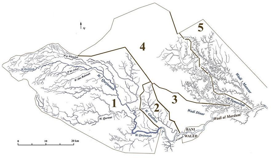
Satellite photos of wadis or dry river beds on the northern edge of the Sahara desert in Libya reveal numerous Romano-Libyan sites dating from AD 100-700. Houses, granaries, cisterns, and stone walls used to control water flow to the fertile bottomland are clearly evident in hundreds of locations along the wadis and their tributaries. As documented in the pioneering archaeological survey, Farming the Desert, edited by Graeme Barker (UNESCO, 1997)], these sites show a now-vanished Berber civilization that had mastered scarce water resources to successfully grow olives and other cash crops for the Roman imperial markets. One of the main drainages is Wadi el Mardum, which flows east through the city of Bani Waled (see map). This is fed by several tributaries flowing down from surrounding hills, including 1) Wadi Qarjuman, 2) Wadi Ghalbun, 3) Wadi Dinar, 4) Wadi Tamasilan, and 5) Wadi Mansur. Their drainages, fed by many tiny wadis, range from about 20-50 km in length. Using the two letter codes for each tributary adopted by the UNESCO survey project, maps have been completed for two of the wadis including Wadi Mansur [Mn], one of the largest and most populated with Romano-Libyan village remains, and the smaller Wadi Ghalbun [Gn], respectively just east and west of Bani Waled. |

|