Athena Review Image Archive ™
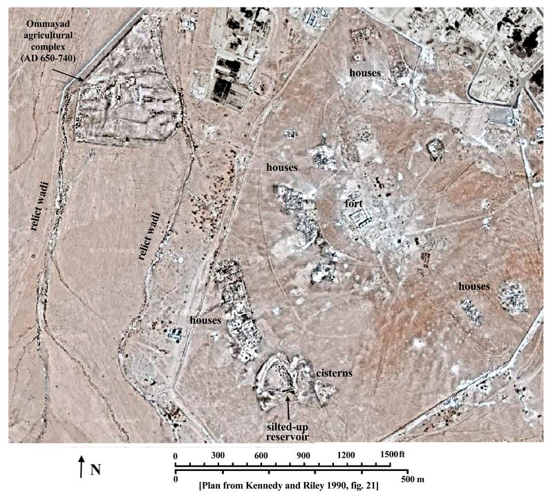
Qasr el Hallabat: Satellite image of ancient town with plan

Qasr el Hallabat: satellite image of town with plan (Google Images; Kennedy and Riley 1990 fig.21.)
The
ancient town of Qasr el Hallabat, located southeast of the modern town,
has both Roman and Ummayad components. Residential areas as well as the
fort and the waterworks contain elements from both periods.
The Roman fort went through several phases of development, and was eventually converted into an Ommayad castle (AD 650-740), when elaborate mosaics were laid in the rooms of the fort (Bisheh, 1980; 1982). Stones from the fort were later reused in a nearby bedouin cemetery. In the Ommayad phase a mosque was built and a bath building constructed a mile away at Hammamas-Sarakh. The agricultural complex in the wadi to the west was also created in this time frame (AD 650-740).
[Source: Kennedy and Riley 1990, Rome's Desert Frontier from the Air.]
.Copyright © 1996-2020 Rust Family Foundation (All Rights Reserved).