Athena Review Image Archive ™
Qasr Deir el Kahaf: Satellite image and aerial photo of fort area
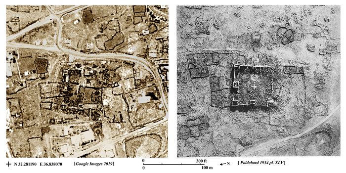
Qasr Deir el Kahaf: satellite image & aerial photo of fort (Google Img.2019; Poidebard 1934 pl 45)
The fort at Qasr Deir el Kahaf is shown at left in a recent satellite photo from 2019, and at right in an aerial photo taken by De Boyyson probably in the early 1930s (Poidebard 1934). In both images the fort is surrounded by stone walled corrals for animals, built by bedouins. In the 80-90 years since the original aerial photo, many of these corrals have shifted their places, and today there are more streets and a number of small houses in a large village built round the fort, which appears less intact than in the 1930s under conditions of denser local settlement and farming.
The site lies on the southeastern edge of the Hauran region, near the border with Syria and about 45 km southeast of the legionary fortress at Bostra. It lay beside a major Roman road probably dating from the Severan period of AD 208–10, which went down to the Azraq Oasis where there was another Roman fort.
Latin inscriptions date construction of the fort at Qasr Deir el Kahaf to AD 306, with a repairs made in the period 367–75. Given the Severan date of the nearby road, Kennedy and Riley (1990) note the possibility of an initial occupation of the site at least a century earlier.
[Sources: Poidebard, A. 1934; Kennedy and Riley 1990, Rome's Desert Frontier from the Air.]
.Copyright © 1996-2020 Rust Family Foundation (All Rights Reserved).